
|
| Our subscribers' grade-level estimate for this page: 4th - 5th |
 Outline Maps |
EnchantedLearning.com World Geography |
 Flags |
| Africa | Antarctica | Asia | Australia/Oceania | Central America/ Caribbean | Europe | Mideast | North America | South America | USA |
| A | B | C | D | E | F | G | H | I | J | K | L | M | N | O | P | Q | R | S | T | U | V | W | X | Y | Z |
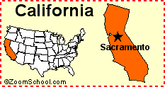 California California is a state on the western coast of the United States of America. Its capital is Sacramento. Map, flag, symbols, printouts, and quizzes. |
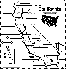 California: Label Me! Printout Label the major features of California. Answers |
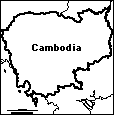 Cambodia: Outline Map Printout An outline map of Cambodia to print. Or go to printable activities that require research (using an atlas or other geography reference): a simple map research activity, a medium-level map research activity, or an advanced map research activity. |
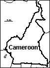 Cameroon: Outline Map Printout An outline map of Cameroon to print. Or go to printable worksheets that require research (using an atlas or other geography reference): a simple map research activity, a medium-level map research activity, or an advanced map research activity. |
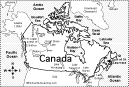
 Canada: Geography, etc. Find information on Canada, including maps, flags, animals, explorers, fossils, art, quizzes, and books to print out. |
Canada: Geography Basic information on Canada's geography. |
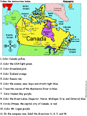 Canada: Follow the Instructions Color the Canada according to simple directions, such as, "Color Hudson Bay purple." Or go to the answers. |
 Canada: Geographic Map Quiz Worksheet Answer questions about the map of Canada. Or go to the answers. |
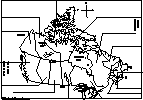
 Canada: Outline Map Printout An outline map of Canada to print. Or go to printable worksheets that require research (using an atlas or other geography reference): a simple map research activity, a medium-level map research activity, or an advanced map research activity. |
 Canada: Dot to Dot Mystery Map Connect the dots to draw the borders of a mystery country. Then use a globe or atlas to figure out which country you have drawn. You might want to give students clues, such as the continent the country is in (North America), that it is in the Northern Hemisphere, or that its name starts with "C." Answer: Canada. |
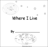 Canada: Where I Live A short activity book on geography to print for early readers. There are pages on the Solar System, the continents, North America, Canada and the student's address. |
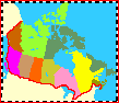
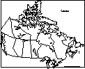
 Canadian Provinces/Territories: Label Me! Printout Label Canada's 13 provinces and territories. |
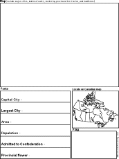 Canadian Province/Territory Report Graphic Organizer Printout #1 This printout helps the student do a short report on a Canadian Province/Territory, prompting the student to draw a map of the province, locate it on a world map, draw the province's flag, and write its capital city, largest city, area, population, date of admittance to confederation, and provincial flower. |
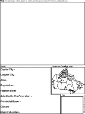 Canadian Province/Territory Report Graphic Organizer Printout #2 This printout helps the student do a short report on a Canadian Province/Territory, prompting the student to draw a map of the province, locate it on a world map, draw the province's flag, and write its capital city, largest city, area, population, highest point, date of admittance to confederation, provincial flower, climate, and major industries. |
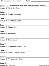 Canada: Write a Question for Each Answer In this worksheet, the student is given a series of short answers using Canadian geography words. For each answer, the student writes a short question. Answers: Arctic Ocean, Pacific Ocean, Atlantic Ocean, Hudson Bay, Baffin Bay, Mount Logan, magnetic North Pole, St. Lawrence River, Mackenzie River, USA. |
Canada: Zoom School Use a pictorial interface to get information on Canada, including maps, animals, explorers, fossils, a quiz, and printouts on Canada. |
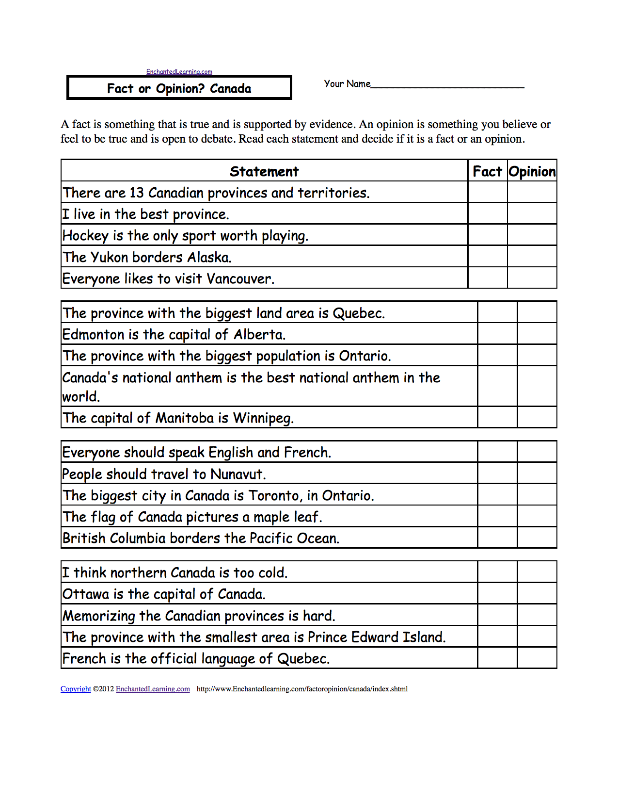 Fact or Opinion? Canada Determine if the statements are facts or opinions. A fact is supported by evidence and can be proven; an opinion is how you feel about something and is open to debate. Or go to the answers. Or go to a pdf of the worksheet and answers (subscribers only). |
Capital Cities of the World The capitals of all of the countries in the world, in alphabetical order by country. Or go to world capitals listed by continent. |
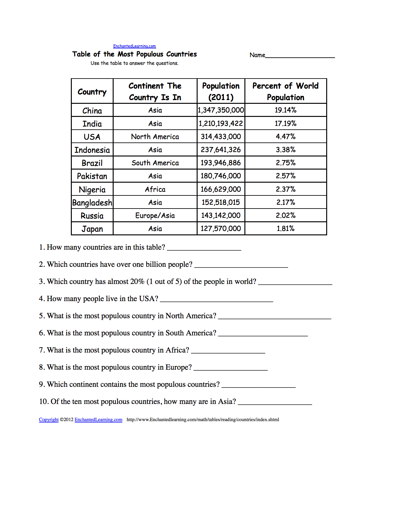 Biggest Capital Cities: Reading and Understanding Tables Use the table to answer the questions about the biggest capital cities. Or go to the answers. Or go to a pdf of the quiz and the answers (site members only). |
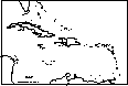 Caribbean: Outline Map Printout An outline map of the Caribbean to print. |
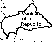 Central African Republic Outline Map An outline map of the Central African Republic to print. |
 Central America and the Caribbean: Geography Geography activities on Central America and the Caribbean. |
 The Census A census is an official count of the number of people in a region. The survey is done by a government, usually periodically. This page explains how and why censuses are taken. |
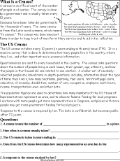 Census: Printable Read-and-Answer Worksheet A printable worksheet on the census, with a short text to read, a map to color, and questions to answer. Or go to the answers. Or go to a pdf file with the worksheet and the answers. |
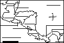
Central America: Label Me! Printout Label the map of Central America. Answers |
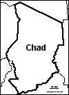 Chad: Outline Map Printout An outline map of Chad to print. Or go to printable activities that require research (using an atlas or other geography reference): a simple map research activity, a medium-level map research activity, or an advanced map research activity. |
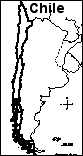 Chile: Outline Map Printout An outline map of Chile to print. Or go to printable activities that require research (using an atlas or other geography reference): a simple map research activity, a medium-level map research activity, or an advanced map research activity. |
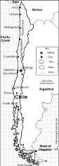 Chile: Map Quiz Worksheet A printable quiz on the major geographic features of Chile. The student reads a map to answer 10 geography questions. Or go to the answers. |
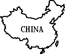
 China Information on China, including maps, flags, crafts, the Great Wall, Chinese New Year, etc. |
 China: Zoom School Use a pictorial interface to get information on China, including maps, flags, printouts, and a quiz. |
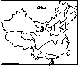
 China: Map Quiz Printout You can print out a map of China, color it, and take a short quiz on the geography of China. Or go to the answers. |
 China: Outline Map Printout An outline map of China to print. Or go to printable activities that require research (using an atlas or other geography reference): a simple map research activity, a medium-level map research activity, or an advanced map research activity. |
 China: Dot to Dot Mystery Map Connect the dots to draw the borders of a mystery country. Then use a globe or atlas to figure out which country you have drawn. You might want to give students clues, such as the continent the country is in (Asia), that it is in the Northern Hemisphere, or that its name starts with "C." Answer: China. |
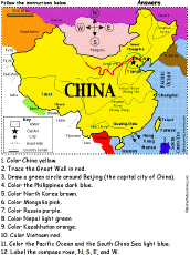 China: Follow the Instructions Color China according to simple directions, such as, "Trace the Great Wall in red." Or go to the answers. |
China: Shape Poem 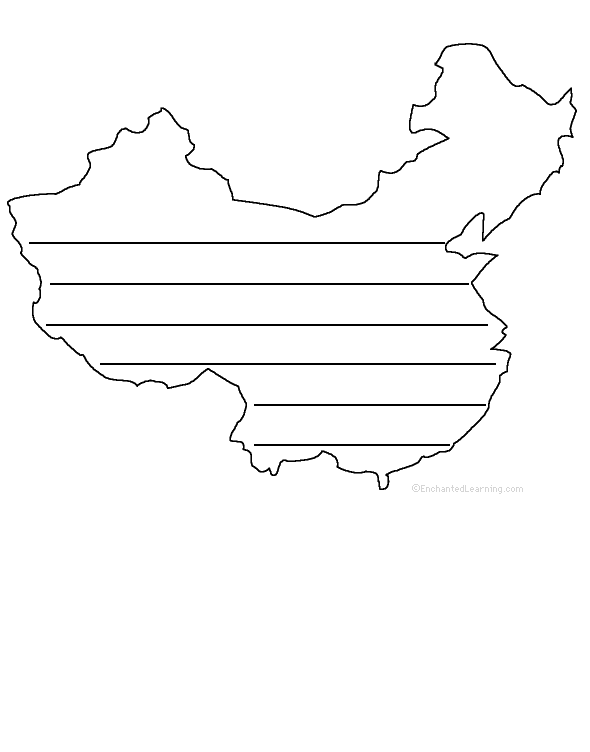 Write a poem about China inside the map. Or go to a pdf of the poem worksheet. |
China: Perimeter Poem  Write a poem around the perimeter (outer edges) of the map. Or go to a pdf of the poem worksheet. |
China: Great Wall of China Information on the Great Wall of China. |
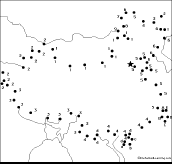
 Chinese Rivers : Outline Map Printout An outline map of China's rivers to print. |
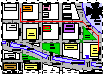 City Map Reading Activity Printout #1 Follow directions and answer questions about a city map. Answers |
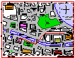 City Map Reading Activity Printout #2 Follow directions and answer questions about a city map. Answers |
 Find a City for Each Letter See if you can think of and write down a city name for each letter of the alphabet. Or go to a sample answer page. |
 All About Colombia Information on Colombia, a country in South America. Do worksheets on the map and the flag of Colombia. |
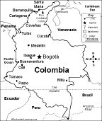 Colombia: Map Quiz Worksheet A printable quiz on the major geographic features of Colombia. The student reads a map to answer 10 geography questions. Or go to the answers. |
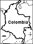 Colombia: Outline Map Printout An outline map of Colombia to print. Or go to printable worksheets that require research (using an atlas or other geography reference): a simple map research activity, a medium-level map research activity, or an advanced map research activity. |
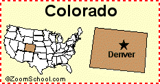 Colorado Colorado is a state in the western United States of America. Its capital is Denver. Map, flag, symbols, printouts, and quizzes. |
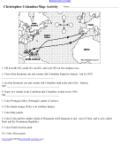 Columbus Map Activity A map activity on Christopher Columbus' 1492 voyage to the New World. Or go to the answers |
 The Compass Directions in Arabic A Label Me! Printout Label the compass (bargal) in Arabic: north, south, east, and west. Answers |
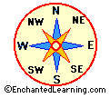
 Compass Directions in English A Label Me! Printout Label the compass directions in English. Answers |
Compass Directions in French A Label Me! Printout Label the compass directions in French. Answers |
Compass Directions in German A Label Me! Printout Label the compass directions in German. Answers |
 Compass Directions in Hebrew A Label Me! Printout Label the compass in Hebrew: north, northeast, east, southeast, south, southwest, west, and northwest. Answers |
Compass Directions in Italian A Label Me! Printout Label the compass directions in Italian. Answers |
Compass Directions in Spanish A Label Me! Printout Label the compass directions in Spanish. Answers |
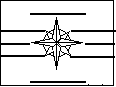
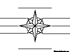
 Compass Rose Printout A compass rose is a design on a map that shows direction. Fill in the directions on this compass rose printout. |
 Compass Rose Map: My Country In this printable map activity, the student has to think about where things are located with respect to a familiar place. For each direction in the compass rose (N, NE, E, SE, S, SW, W, NW), write something that is located in that direction from your country. |
 Compass Rose Map: My Home In this printable map activity, the student has to think about where things are located with respect to a familiar place. For each direction in the compass rose (N, NE, E, SE, S, SW, W, NW), write something that is located in that direction from home. |
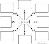 Compass Rose Map: My School In this printable map activity, the student has to think about where things are located with respect to a familiar place. For each direction in the compass rose (N, NE, E, SE, S, SW, W, NW), write something that is located in that direction from your school. |
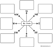 Compass Rose Map: My State In this printable map activity, the student has to think about where things are located with respect to a familiar place. For each direction in the compass rose (N, NE, E, SE, S, SW, W, NW), write something that is located in that direction from your state. |
 Compass Rose Map: My Town In this printable map activity, the student has to think about where things are located with respect to a familiar place. For each direction in the compass rose (N, NE, E, SE, S, SW, W, NW), write something that is located in that direction from your town. |
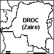 Congo, Democratic Republic - Outline Map An outline map of DROC to print. |
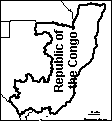 Congo, Republic of the An outline map of the Republic of the Congo to print. |
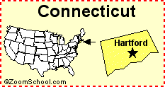 Connecticut Connecticut is a state in the northeastern United States of America. Its capital is Hartford. Map, flag, symbols, printouts, and quizzes. |
 Continental Drift See how and why the continents are slowly changing their position and shape. |
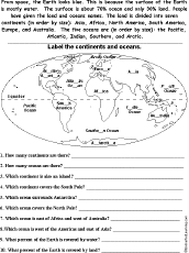 Continents and Oceans: Printable Read-and-Answer Worksheet A printable worksheet on continents and oceans, with a short text, a map to label, and questions to answer. Or go to the answers. |
Continents and Oceans Quiz Print out this quiz and learn about the oceans and continents on Earth. Or go to the answers. |
 Continents: Cloze Activity Do a printable fill-in-the-blanks activity on the Earth's seven continents. Or go to the answers. |
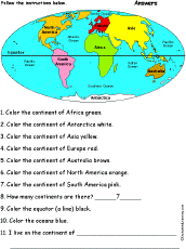 Continents: Follow the Instructions Draw and color the continents according to simple directions, such as, "Color the continent of Africa green." Or go to the answers. |
 Color and Count the Continents: Follow the Instructions Color and count the continents according to simple directions, such as, "How many continent start with the letter "A"?." Or go to the answers. |
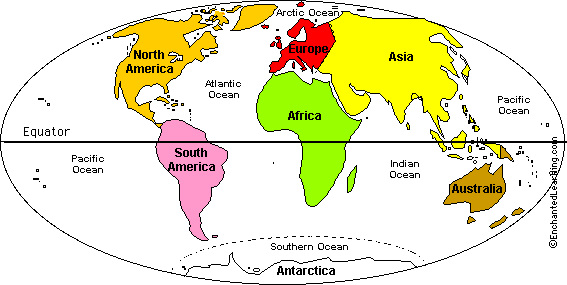
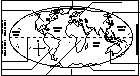 Continents: Label the Map Label the continents, the poles, and the equator. |
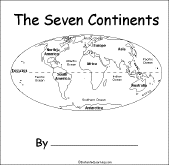 The Seven Continents A short activity book on the continents to print for early readers. There are pages on each of the seven continents. |
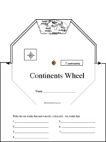 Continents Wheel Make a continents wheel using this 2-page print-out; it consists of a base page together with a wheel that spins around. When you spin the wheel, the continents appear, one at a time: Africa, Antarctica, Asia, Australia, Europe, North America, and South America. The student then writes the names of the continents in alphabetical order. |
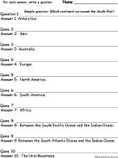 Continents: Write a Question for Each Answer In this worksheet, the student is given a series of short answers using continent-related words. For each answer, the student writes a short question. |
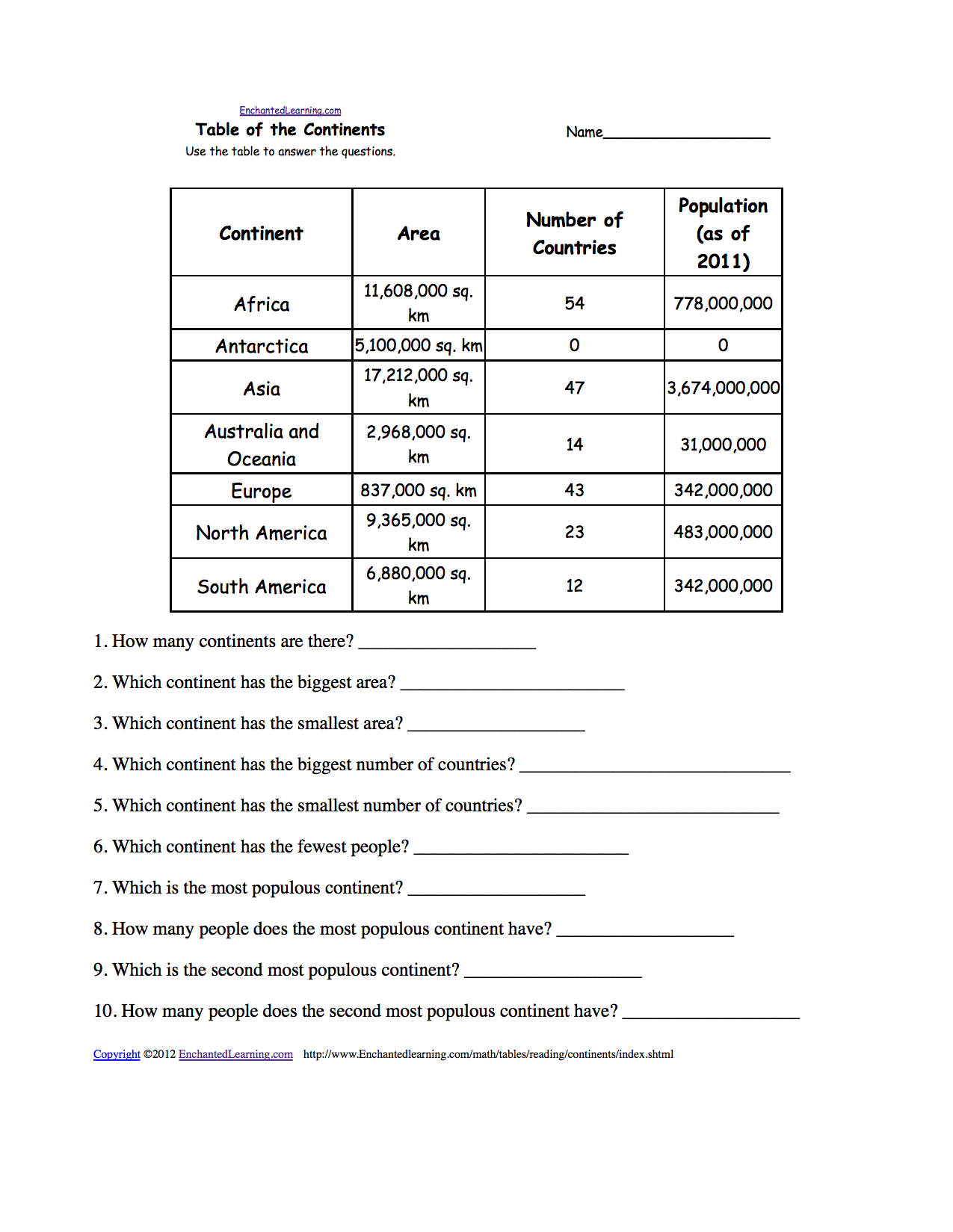 The Continents: Reading and Understanding Tables Use the table to answer the questions about the continents. Or go to the answers. Or go to a pdf of the quiz and the answers (site members only). |
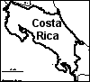 Costa Rica: Outline Map Printout An outline map of Costa Rica to print. Or go to printable worksheets that require research (using an atlas or other geography reference): a simple map research activity, a medium-level map research activity, or an advanced map research activity. |
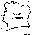 Cote d'Ivoire: Outline Map Printout An outline map of Cote d'Ivoire to print. Or go to printable activities that require research (using an atlas or other geography reference): a simple map research activity, a medium-level map research activity, or an advanced map research activity. |
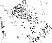
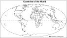 Countries of the World Outline Map Printout An outline map of the countries of the world to print. |
 Country Name Anagram Puzzle Worksheet On this printable worksheet, the student writes a country name for each anagram. Or go to the answers |
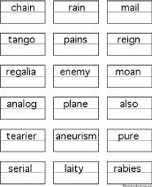
Nepal panel penal plane Country Anagrams An anagram is a word that is made by rearranging the letters of another word. For example, Iran is an anagram of rain. Some examples include: China/chain, Mail/mail, Niger/reign, Peru/pure, Spain/pains, Tonga/tango. This page has many country name anagrams and printable anagram puzzles. |
My Country: Compass Rose Map In this printable map activity, the student has to think about where things are located with respect to a familiar place. For each direction in the compass rose (N, NE, E, SE, S, SW, W, NW), write something that is located in that direction from your country. |
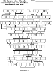 Countries - Letter-Flow Printable Word Puzzle Can you figure out the names of these ten countries? When a line connects two (or more) boxes, those boxes each contain the same letter. Countries: Switzerland, Saudi Arabia, United Arab Emirates, United Kingdom, Turkmenistan, Papua New Guinea, Dominican Republic, Afghanistan, Bangladesh, Madagascar. Or go to the answers. Or go to a pdf file of the puzzle plus the answers. |
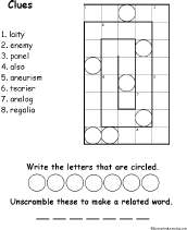 Country Name Anagram Spiral Picture Puzzle Worksheet #1 Solve the country anagram clues then put the words in the spiral puzzle. An anagram is a word that is made by rearranging the letters of another word. This is a tricky puzzle. Or go to the answers. |
 Find a Country for Each Letter See if you can think of and write down a country name for each letter of the alphabet. Or go to a sample answer page. |
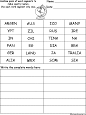 Country Name Word Pieces Puzzle In this puzzle, combine pairs of word segments to make country names. Words: Argentina, Australia, Brazil, China, Egypt, India, Japan, Germany, Ireland, Mexico, Russia, Somalia. Or go to the answers. |
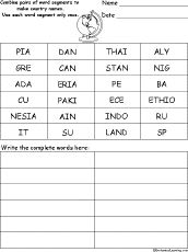 Country Name Word Pieces Puzzle #2 In this puzzle, combine pairs of word segments to make country names. Words: Canada, Cuba, Ethiopia, Greece, Indonesia, Italy, Nigeria, Pakistan, Peru, Spain, Sudan, Thailand. Or go to the answers. |
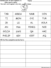 Country Name Word Pieces Puzzle #3 In this puzzle, combine pairs of word segments to make country names. Words: Algeria, Angola, Chile, France, Haiti, Iraq, Mongolia, Philippines, Qatar, Sweden, Turkey, Vietnam. Or go to the answers. |
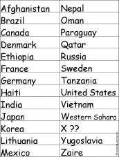
 List of Country Names This is a word bank of country names. |
Country Name Anagrams This is a word bank of anagrams of country names. An anagram is a word or phrase that is made by rearranging the letters of another word or phrase. For example, China is an anagram of chain. |
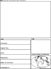 Country Report Graphic Organizer Printout This printout helps the student do a short report on a country, prompting the student to draw a map of the country, locate it on a world map, draw the country's flag, and write the country's continent, capital city, area, population, name of currency, and language(s). |
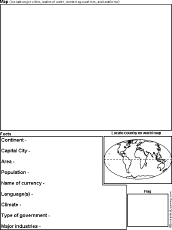 Country Report Graphic Organizer Printout #2 This printout helps the student do a short report on a country, prompting the student to draw a map of the country, locate it on a world map, draw the country's flag, and write the country's continent, capital city, area, population, name of currency, language(s), climate, type of government, and major industries. |
 Country Wheel This 2-page print-out makes a wheel about a single country; the student fills out the information on the wheel. It consists of a base page together with a rear wheel that spins around. After putting the wheel together, the student follows the instructions on the front wheel (coloring in the country on a world map and drawing a small map of the country) and fills out the 12 sections of the wheel with information about one country. When you spin the wheel, facts about the US State appear, including: Biggest Cities, Capital, Flag, Type of Government, Name of Currency, Area, Population, Major Languages, Residents Called, Bordered by, Major Industries, and Continent. |
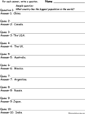 Countries #1: Write a Question for Each Answer In this worksheet, the student is given a series of short answers using country names. For each answer, the student writes a short question. Countries: China, Canada, the USA, the UK, Australia, Mexico, Argentina, Russia, Japan, India. |
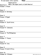 Countries #2: Write a Question for Each Answer In this worksheet, the student is given a series of short answers using country names. For each answer, the student writes a short question. Countries: Brazil, Germany, Egypt, South Korea, Indonesia, the Philippines, France, Iran, South Africa, Ethiopia. |
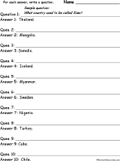 Countries #3: Write a Question for Each Answer In this worksheet, the student is given a series of short answers using country names. For each answer, the student writes a short question. Countries: Thailand, Mongolia, Somalia, Iceland, Myanmar, Sweden, Nigeria, Turkey, Cuba, Chile. |
Crafts and Activities about Geography These are crafts that help you learn geography. |
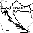 Croatia Outline Map Printout An outline map of Croatia to print. Or go to printable worksheets that require research (using an atlas or other geography reference): a simple map research activity, a medium-level map research activity, or an advanced map research activity. |
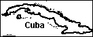 Cuba: Outline Map Printout An outline map of Cuba to print. |
 Cylindrical Projection: World Latitude and Longitude (Outline Map Printout) An outline map of world latitudes and longitudes to print (a cylindrical projection - it has straight lines of latitudes and longitude, but the areas near the poles are exaggerated in size). |
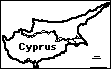 Cyprus: Outline Map Printout An outline map of Cyprus to print. |
 Czech Republic: Outline Map Printout An outline map of the Czech Republic to print. Or go to printable worksheets that require research (using an atlas or other geography reference): a simple map research activity, a medium-level map research activity, or an advanced map research activity. |
| EnchantedLearning.com World Geography |
Flags |
| Africa | Antarctica | Asia | Australia/Oceania | Central America/ Caribbean | Europe | Mideast | North America | South America | USA |
| A | B | C | D | E | F | G | H | I | J | K | L | M | N | O | P | Q | R | S | T | U | V | W | X | Y | Z |
Enchanted Learning®
Over 35,000 Web Pages
Sample Pages for Prospective Subscribers, or click below
|
Overview of Site What's New Enchanted Learning Home Monthly Activity Calendar Books to Print Site Index K-3 Crafts K-3 Themes Little Explorers Picture dictionary PreK/K Activities Rebus Rhymes Stories Writing Cloze Activities Essay Topics Newspaper Writing Activities Parts of Speech Fiction The Test of Time
|
Biology Animal Printouts Biology Label Printouts Biomes Birds Butterflies Dinosaurs Food Chain Human Anatomy Mammals Plants Rainforests Sharks Whales Physical Sciences: K-12 Astronomy The Earth Geology Hurricanes Landforms Oceans Tsunami Volcano |
Languages Dutch French German Italian Japanese (Romaji) Portuguese Spanish Swedish Geography/History Explorers Flags Geography Inventors US History Other Topics Art and Artists Calendars College Finder Crafts Graphic Organizers Label Me! Printouts Math Music Word Wheels |
Click to read our Privacy Policy
| Search the Enchanted Learning website for: |
Copyright ©2002-2018 EnchantedLearning.com ------ How to cite a web page