
|
| You might also like: | Terms for the Map of Brazil Printout | Flag of Suriname Printout | Label the Map of Brazil Printout | Outline Map: Brazil | Outline Map: Bolivia | Today's featured page: United Kingdom |
| Our subscribers' grade-level estimate for this page: 2nd - 3rd |

Brazil's Flag
More GeographyEnchantedLearning.com
All About Brazil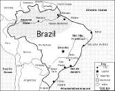
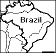
Map/Quiz Printout
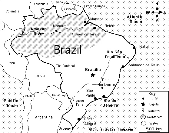
Location: Brazil (the Federative Republic of Brazil) is a large country in eastern South America. Brazil is bordered by Argentina, Bolivia, Colombia, French Guiana, Guyana, Paraguay, Peru, Suriname, Uruguay, and Venezuela.
Size: Brazil covers about 8,511,965 square kilometers. Brazil is the 5th largest country in the world (after Russia, Canada, the USA, and China).
Population: Brazil has the 5th largest population of any country in the world (after China, India, the USA, and Indonesia). The population of Brazil is about 201,103,330 (as of July, 2010).
Government: Brazil is a federal republic that is divided into 26 states (estados) and 1 federal district.
Official Language: Portuguese
Education: Girls and boys in Brazil go to school for an average of 14 years.
Literacy Rate: About 88.6% of the adults in Brazil can read and write. About 88.4% of the men and 88.8% of the women are literate.
Religion: Roman Catholic (nominal) 73.6%, Protestant 15.4%, Spiritualist 1.3%, Bantu/voodoo 0.3%, other 1.8%, unspecified 0.2%, none 7.4%.
Flag: Brazil's flag is a deep green banner with a yellow diamond enclosing a night-blue, star-studded Southern Hemisphere sky. The sky depicts 27 white, five-pointed stars (one for each state and the Federal District); the stars are arranged in the pattern of the night sky over Rio de Janeiro on November 15, 1889 (this is the date when the last Emperor of Brazil, Dom Pedro II, was deposed, and the republic was proclaimed). The stars in view include the constellations Southern Cross (also called Crux), Scorpius, Canis Major and others. A banner across the sky reads, "ORDEM E PROGRESSO," which means "order and progress" in Portuguese.
Climate: Brazil's climate is mostly tropical, but temperate in the south.
Rainforest: The Amazon Rainforest stretches across the north of Brazil. Sixty percent of the Amazon Rainforest is in Brazil; this the biggest rainforest in the world.
Major Rivers: The major rivers in Brazil are the Amazon, the Paraná and its major tributary, the Iguaçu, and the Negro, São Francisco, Xingu, Madeira and Tapajós rivers.
Mountains: Central and southern Brazil are mountainous.
Highest Point: The highest point in Brazil is Mt. Pico da Neblina (3,014 meters or 9,735 ft), on the border with Venezuela. Pico da Neblina means "Misty Peak" in English.
Lowest Point: The lowest point in Brazil is the Atlantic Ocean, at sea level.
Natural Resources: bauxite, gold, iron ore, manganese, nickel, phosphates, platinum, tin, rare earth elements, uranium, petroleum, hydropower, timber.
Major Industries: textiles, shoes, chemicals, cement, lumber, iron ore, tin, steel, aircraft, motor vehicles and parts, other machinery and equipment.
Agricultural Products: coffee, soybeans, wheat, rice, corn, sugarcane, cocoa, citrus; beef.
Brazil: Map Quiz Worksheet A printable quiz on the major geographic features of Brazil. The student reads a map to answer 10 geography questions. Or go to the answers. |
Brazil's Flag Quiz/Printout A quiz and coloring printout on the Brazilian flag. |
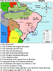 Brazil: Follow the Instructions Color Brazil according to simple directions, such as, "Draw green stripes on the Amazon Rainforest." Or go to the answers. |
 Brazil's Map: Label Me! Printout Label the map of Brazil. Answers |
 Brazil: Outline Map Printout An outline map of Brazil to print. Or go to printable worksheets that require research (using an atlas or other geography reference): a simple map research activity, a medium-level map research activity, or an advanced map research activity. |
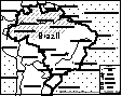
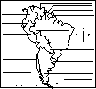 South American Countries Printout: Label Me! Printout Label the countries of South America. Answers |
Reference:
https://www.cia.gov
Enchanted Learning®
Over 35,000 Web Pages
Sample Pages for Prospective Subscribers, or click below
|
Overview of Site What's New Enchanted Learning Home Monthly Activity Calendar Books to Print Site Index K-3 Crafts K-3 Themes Little Explorers Picture dictionary PreK/K Activities Rebus Rhymes Stories Writing Cloze Activities Essay Topics Newspaper Writing Activities Parts of Speech Fiction The Test of Time
|
Biology Animal Printouts Biology Label Printouts Biomes Birds Butterflies Dinosaurs Food Chain Human Anatomy Mammals Plants Rainforests Sharks Whales Physical Sciences: K-12 Astronomy The Earth Geology Hurricanes Landforms Oceans Tsunami Volcano |
Languages Dutch French German Italian Japanese (Romaji) Portuguese Spanish Swedish Geography/History Explorers Flags Geography Inventors US History Other Topics Art and Artists Calendars College Finder Crafts Graphic Organizers Label Me! Printouts Math Music Word Wheels |
Click to read our Privacy Policy
| Search the Enchanted Learning website for: |